
Monitoring Data for Kīlauea Active
For more information on how electronic tiltmeters and GPS receivers help monitor the deformation of Kīlauea Volcano, see the HVO Deformation page.

Click image at right for larger map. Data plots from additional stations are available from our interactive map, which allows you to view different types of data (using the right-side menu on the map).
Electronic Tilt at Kīlauea Summit - Past 2 Days
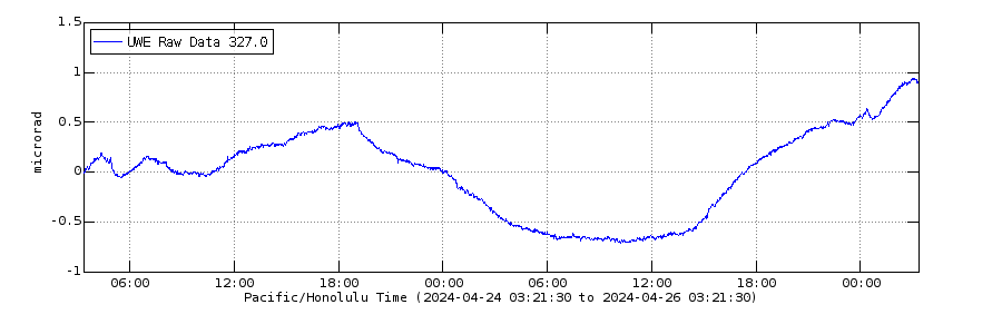
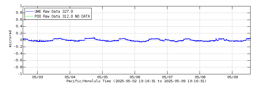
Electronic Tilt at Kīlauea Summit and East Rift Zone - Past Week
Electronic Tilt at Kīlauea Summit and East Rift Zone - Past Month
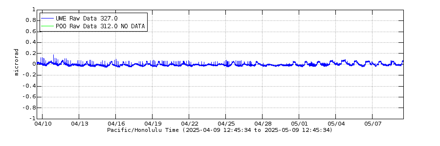
Above: The blue line shows the radial tilt at Uwekahuna Station (UWE), on the western rim of Kīlauea's caldera. The green line is a radial tilt at Pu‘u‘ō‘ō (POO), north of Pu‘u‘ō‘ō cone; this instrument is currently experiencing a long-term outage. These are recorded by continuously operating electronic tiltmeters. Positive changes often indicate inflation of the magma storage areas beneath the caldera or Pu‘u‘ō‘ō, but may also result from heavy rainfall or, occasionally, instrumental malfunctions.
Global Positioning System - Kīlauea Summit
Past Year
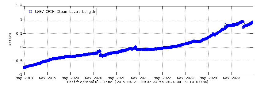
Past Five Years
Global Positioning System - Pu‘u‘ō‘ō Cone
Past Year
Past Five Years
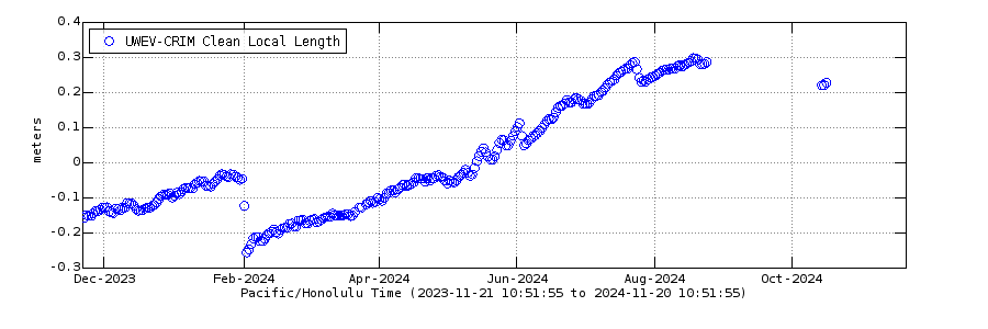
Above SUMMIT GPS: Change in distance between two Global Positioning System (GPS) stations located on opposite sides of Kīlauea's caldera. A rapid increase in distance can be interpreted as inflation of the summit magma reservoir or Pu‘u‘ō‘ō magma storage chamber. Above Pu‘u‘ō‘ō GPS: Change in distance between two station near Pu‘u‘ō‘ō. A rapid increase in distance can be interpreted as inflation of the summit magma reservoir Pu‘u‘ō‘ō magma storage chamber.

Past Week Monitoring Data for Kīlauea
Past Month Monitoring Data for Kīlauea
Past Year Monitoring Data for Kīlauea
Past 5 Years Monitoring Data for Kīlauea
- Overview
For more information on how electronic tiltmeters and GPS receivers help monitor the deformation of Kīlauea Volcano, see the HVO Deformation page.
Sources/Usage: Public Domain. View Media DetailsSelect deformation instruments located on Kīlauea Volcano. (Public domain.) Click image at right for larger map. Data plots from additional stations are available from our interactive map, which allows you to view different types of data (using the right-side menu on the map).
Electronic Tilt at Kīlauea Summit - Past 2 Days
Remote image UrlSources/Usage: Public Domain. View Media DetailsElectronic Tilt at Kīlauea Summit and East Rift Zone - Past Week
Remote image UrlSources/Usage: Public Domain. View Media DetailsElectronic Tilt at Kīlauea Summit and East Rift Zone - Past Month
Remote image UrlSources/Usage: Public Domain. View Media DetailsAbove: The blue line shows the radial tilt at Uwekahuna Station (UWE), on the western rim of Kīlauea's caldera. The green line is a radial tilt at Pu‘u‘ō‘ō (POO), north of Pu‘u‘ō‘ō cone; this instrument is currently experiencing a long-term outage. These are recorded by continuously operating electronic tiltmeters. Positive changes often indicate inflation of the magma storage areas beneath the caldera or Pu‘u‘ō‘ō, but may also result from heavy rainfall or, occasionally, instrumental malfunctions.
Global Positioning System - Kīlauea Summit
Past Year
Remote image UrlSources/Usage: Public Domain. View Media DetailsPast Five Years
Remote image UrlSources/Usage: Public Domain. View Media DetailsGlobal Positioning System - Pu‘u‘ō‘ō Cone
Past Year
Remote image UrlSources/Usage: Public Domain. View Media DetailsPast Five Years
Remote image UrlSources/Usage: Public Domain. View Media DetailsAbove SUMMIT GPS: Change in distance between two Global Positioning System (GPS) stations located on opposite sides of Kīlauea's caldera. A rapid increase in distance can be interpreted as inflation of the summit magma reservoir or Pu‘u‘ō‘ō magma storage chamber. Above Pu‘u‘ō‘ō GPS: Change in distance between two station near Pu‘u‘ō‘ō. A rapid increase in distance can be interpreted as inflation of the summit magma reservoir Pu‘u‘ō‘ō magma storage chamber.
- Science
Past Week Monitoring Data for Kīlauea
This page presents Kīlauea monitoring data collected over the past week, including summit lava lake level, earthquake rates, locations, and depths, and ground deformation data.Past Month Monitoring Data for Kīlauea
This page presents Kīlauea monitoring data collected over the past month, including summit lava lake level, earthquake rates, locations, and depths, ground deformation data and gas data.Past Year Monitoring Data for Kīlauea
This page presents Kīlauea monitoring data collected over the past year, including earthquake rates, locations, and depths, ground deformation data, and gas data.Past 5 Years Monitoring Data for Kīlauea
This page presents Kīlauea monitoring data collected over the past five years, including earthquake rates, locations, and depths and ground deformation data.